Tuesday, December 24, 2013

Holiday Forecast

(Courtesy of National Weather Service)

Christmas Eve
Afternoon: Chance of flurries until 4 pm. Winds will start gusting over 30 mph after 3 pm. Temps staying in the mid 30's.
Evening: Clouds diminishing. Temps dropping just below 30 degrees. Winds dying down but still over 10 mph.
Night: COLD. Clear with a low of 18 degrees.
Christmas Day
Morning: Mainly clear with temps reaching 30 degrees. Calm winds.
Afternoon: High of 35 degrees. Calm winds and sunny skies.
Night: Clear with a low of 25 degrees.
Synopsis
High pressure will continue to build through Thursday. A cold front will pass through and off the coast today. As cold as 17 degrees tonight.

Saturday, December 21, 2013

'Tis the season?

Radar image at 9:00 pm Saturday night. Base of low pressure system will spiral up the east coast, washing away warm temperatures and bringing cold air back for Christmas.
It was quite the surprise to see temperatures reach 72 degrees in my hometown of Winchester, VA. It just doesn't seem right looking at Christmas lights in spring weather. If you're enjoying this warm weather, I have some bad news for you. If you're not really feelin' these awkward conditions, I have some great news for you.

Temperatures will continue to stay in the upper 60s tomorrow. A low pressure system will sweep into the area early Monday morning bringing colder temperatures for Christmas day. Expect high temperatures to be around 35 degrees by then. Believe it or not, the historical average high temperature for Christmas day in Winchester is 51 degrees. So our high of 35 degrees will be well below average.
For Sunday, expect off and on showers all day long. Don't be surprised if you hear a rumble of thunder between noon and 5 pm. The high will be 67 degrees. Winds increasing.

Monday morning is when the low pressure system will move into the area. Temperatures will fall, winds will get stronger (15 mph), and rain will be possible.

High pressure will be building in Winchester between Tuesday and Thursday. This will bring clear skies and temps below 40 degrees on Christmas day.

Monday, December 9, 2013

Winter Storm Update!

So this storm has changed a bit in the past 12 hours. When I first posted about this storm this morning, the radar was clear for most of the Southeast and Mid-Atlantic as the rest of Dion has cleared out to sea up near Maine and Newfoundland. What remains though is a strong Low that will make its way up the I-95 corridor tonight into tomorrow. In doing so, it will produce the areas first real snowstorm of the season.

We have already seen winter weather with Dion. I assure you though that this storm will be all snow. The atmospheric temperatures are cooled and are conducive for accumulation on the ground. What this means is that snow will not changing over to anything else and will be heavy and wet due to the temperatures near the freezing mark and extremely high humidity. (Notice that by the fog this evening).

The accumulation predictions because of these previous statements are now higher than they were this morning, but not by much. Look for 3-6 inches of snow for the immediate Metropolitan area and upwards of 6 inches in areas to the South and West of DC. So far all public schools in the area have closed down.

Here is the updated probable timeline for this storm:

Monday Night Temperatures near 31-32 the entire night extremely foggy-visibility under 1/4 mile, no precipitation  


Tuesday 6AM-9AM-Light snow showers developing in the area, accumulation light to this point, temperatures still near 31-32


Tuesday 9AM-12PM: Storm will build in intensity and accumulation. Up to 2 inches an hour. Look for highest accumulations between 10-11AM.


Tuesday 12PM-3PM: Snow will continue through the afternoon though after this time it will mostly be in snow shower form


Tuesday 3pm-Late: Snow fall will end by evening-Temperatures will fall into the teens, Wind Chills in the single digits. Please stay inside as much as possible. 


Again stay safe everyone!

-James

Saturday, December 7, 2013

UPDATE: Winter Storm Dion Forecast

DionStatue
*Winter Storm Warning in effect until 10:00 am December 9th*

UPDATE (3:00 PM)

The snow portion of the storm ended around 2:30 pm this afternoon. Expect sleet to freezing rain this afternoon, evening, and throughout the night.

Temperatures will stay below freezing all night long. This will make for slick to icy surfaces in many areas. Even after treatment, the sidewalks and roads around the Fairfax campus have been very slick today. Conditions tonight will be much worse, so please plan ahead and be safe.

As with the last storm, I have a timeline below. Look for my updates as this forecast will probably change in the coming hours. If you have questions, contact Katie Thomas, James Luehrs, or myself over Facebook, Twitter, or email. Be safe!


SUNDAY AFTERNOON: Sleet to freezing rain. High of 30 degrees. Surface glazing.


SUNDAY EVENING: Sleet and freezing rain. Temps steady at 30 degrees.


SUNDAY NIGHT: Sleet and freezing rain all night. Temps rising to 32 degrees.


MONDAY MORNING: Freezing rain to rain. Temps reaching 41 degrees. Melting should begin.


Thursday, December 5, 2013

Is Weather Being Presented Properly?

The way weather is presented to the public is a concept that I constantly struggle with. It envelops the mass internal debate I have that goes beyond the confines of this blog. With that in mind, here is my opinion on why weather is not being presented correctly to the average populace.
Image
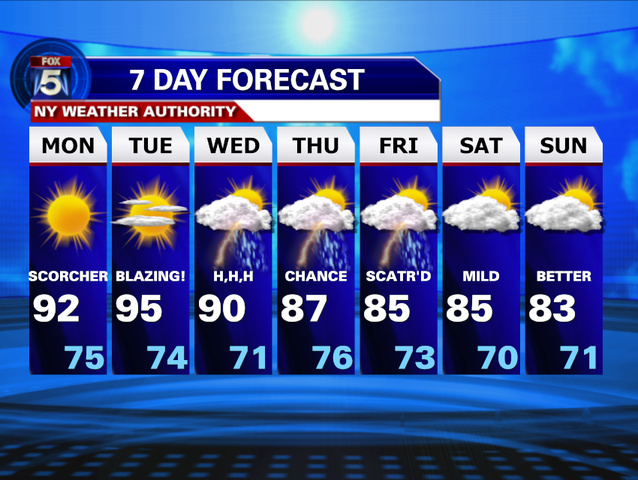
Where are they getting these numbers from? What’s the chance?

“There’s a 90 percent chance of rain and snow this weekend.” It is this mundane statistical statement that means almost nothing to the viewer. The massive amount of data, supercomputer analysis, and mathematical prowess that are required to produce that statement is almost unparalleled. Yet we purely just absorb this monotonous thirty-second blurb spat to us from some face on a screen and give absolutely no thought to the effort it took to make.
As you can probably see, I think that people should pay more attention to the process behind a weather forecast. The fact is, it was just less than 50 years ago that this concept of a daily forecast was a foreign to many. Daily observations were written with pen and paper, and many of the predictions were based off of climate classifications and the limited knowledge of weather systems. The lengths that the technology has caught up with the demand of instant gratification of weather data are truly remarkable. With a few clicks of a button, I can find out the temperature, humidity, and dew point for almost anywhere in the world. Beyond that, I can look at simulations of the atmosphere up to 8 days in the future at ease for almost any variable observed. With this being said, even I can become an amateur weatherman that rivals the news.
Image
WRF (Weather Research and Forecasting) Models coming out of Penn State University-hence where the forecast actually comes from

So where does that leave the weather being presented on the mainstream news media? It does in fact get the job done. People rely on the forecast and rarely do the results waiver. The times though that people want more in depth details on the forecast is when of course there is more at stake. In these dire cases, people become entranced by every minute’s detail as their lives literally hinge on computer data being updated every 4-6 minutes. For example this weekend with the incoming ice/sleet/snow/rain storm, the search for truth is ongoing up to the moment it arrives. For now, the weary speculations are the only truths that can be grasped. By tomorrow though, 24-hour cable will be running seamless coverage of this incoming winter storm.
Maybe my thoughts are far fetched, but I think that the atmosphere is so foreign to people. Even experts in the field are just now finding out the simplest processes to be more complex than once thought. For example, aspects of the mechanisms that produce raindrop formation within a cloud are still in question.* Imagine that…
I look at the Weather Channel, my long time go-to when it comes to expert field analysis and credentialed expertise, and find that it too has tried to branch more towards an entertainment standpoint. In the process, I think they have unintentionally “dumbed down” and oversimplified the news in the hopes of raising ratings. Their featured website, weather.com, is cluttered with various unrelated videos and ads that detracts from the legitimacy of the website. If they are supposedly the best source for weather news in the nation and are faced with the issue of relevancy, what does the future hold for weather related news? Will it land up serving as background noise to the ‘more pressing issues of the day’ like 10 hours of repeated coverage of a case we are forced to care about? These are questions that I have to ask myself, as I hope to enter the field of meteorology.
Image
Would you really know this a weather related site first glance?

So because of this, I think we should treat the reporting of weather from a more educational standpoint. I think atmospheric research should be put at the exact same level as health and medicine breakthroughs. They have just as much of an impact on our livelihood. I am aware that this might completely deviate from the way that news is given today and realistically this all is just a pipe-dream on my part. Then again, imagine if media’s purpose was to educate and inspire, not just to entertain and inform. That’s a bigger issue that I will not delve into, at least not here.
Whenever people ask what I want to do when I grow up, my mind wanders from place to place, as we all tend to do when asked this puzzling question. For now though, my purpose lies in the advocacy for a different perspective in the way weather is taught, and presented to us. It might be the best way for us to combat the many issues that face our humanity, such as climate change and increasing pollution. The answer lies within the informed populace. The change starts today.


 *For those who do not believe me or just want to know about inner-cloud microphysics-http://earth.huji.ac.il/data/pics/khain_qjrms_2005.pdf

Recent Tornado Outbreak

As you read the news or turned on your TV two weekends ago you might have been surprised to hear about the recent tornado outbreak in the Midwest. You usually hear about these destructive outbreaks during tornado season, and for the area impacted recently their season wrapped up with the end of summer. So why did we see such powerful storms this late in fall?

On the weekend of  Nov.16th an atypical powerful late-season strand of thunderstorms moved across the Midwest. This wave of storms contained intense destructive winds that spun off tornadoes in 12 different states. The strongest, an EF-4, hit Washington, Illinois and destroyed entire neighborhoods. This late-season outbreak is the strongest November outbreak in the past 8 years.

The twisters two weekends ago affected 12 different states: Michigan, Wisconsin, Iowa, Illinois, Missouri, Indiana, Ohio, Kentucky, Tennessee, West Virginia, Pennsylvania and western New York.

        Quick Facts
  • Death toll rises to 6 

  • A preliminary rating of EF4 has been given to the tornado that hit New Minden, Ill. (170-190 mph)

  • A preliminary EF4 tornado hit Washington, Ill. (166-200 mph)

  • Preliminary EF2 tornado hit near Coal City, Ill. (111-135 mph)

  • A slew of tornadoes in Indiana, with at least six twisters rated EF2 or stronger

  • At least two tornadoes confirmed in far northern Tennessee

  • EF0 tornado confirmed in Otsego County, Mich. (65-75 mph); northernmost tornado this late in the year for the state

  • EF1 tornado in Butler County, Ky. (105 mph max.)
       SOURCE: THE WEATHER CHANNEL

The question we have to ask ourselves now, is there a general rising trend of tornadoes?

SOURCE: The Weather Channel
 SOURCE: NOAA

Although there is no trend for tornadoes getting stronger, there is a positive trend for more tornadoes. According to the NOAA, there is a general increasing number of tornadoes each year. With the increasing number of tornadoes it is possible to have more late-season tornadoes. Why do we see more tornadoes? Is it due to climate change? Surprisingly, climate change does not play any factor in the growing number of tornadoes. When examining a correlation between climate change and the increasing number of tornadoes over the past decades, there is no strong positive trend in the numbers of tornadoes stronger than EF-0. This suggests, as of now, that climate change is not having a clear influence on U.S. tornadoes. So the increase is possibly due to these factors unrelated to climate change:

1) Population growth has resulted in more tornadoes being reported.

2) Advances in weather radar. Today’s Doppler radar technology has resulted in a more accurate tornado detection rate.

3) Tornado damage surveys have grown more sophisticated over the years. For instance, they now classify multiple tornadoes along the path of destruction that might have been attributed to just one twister in the past.


Here is some RAW VIDEO from a survivor of the Washington Tornado this past outbreak. The video also demonstrates how powerful tornadoes are and how fast they can travel while on the ground.


As you can see in this video, as a tornado strikes you have very little time to prepare or get to safety. And as fast as the tornado strikes, it’s gone and like the family in this video, you could lose everything. So it is important to be prepared for whenever disaster strikes. Although tornadoes are not common in the Fairfax and surrounding areas, it’s always important to be prepared in advance. Follow this link for to learn more about tornado safety and preparedness, http://www.weather.gov/ctp/TornadoSafety.

-Katie